Maps of current semi-natural forest ecosystem types of Germany and the Kellerwald National Park (Hesse, Germany)
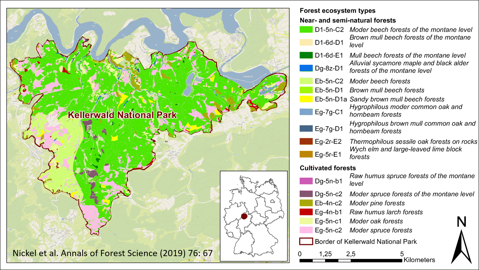
Map of current forest ecosystem types (cEsT) in the Kellerwald National Park
A spatial explicit approach coping with potential modifications in ecological structures and functions of forests due to climate change and atmospheric deposition was developed for Germany (Jenssen et al. 2013; Schröder et al. in Sci Total Environ 521–522:108–122, 2015). As a result, two maps of current semi-natural forest ecosystem types of Germany (1991–2010) and the Kellerwald National Park (2001–2010) are presented. The data provided (Nickel et al. 2018) are accessible at https://doi.org/10.1594/PANGAEA.887305 and comprise 120 ecosystem types (89 near-natural ecosystems, 31 cultivated ecosystems) covering 27% of Germany’s territory and, respectively, 17 forest types (12 near-natural, 5 cultivated) covering 86% of the National Park area. The data are in particular of relevance for spatial ecology and conservation purposes. Associated metadata is available at https://agroenvgeo.data.inra.fr/geonetwork/srv/fre/catalog.search#/metadata/b5e5d76f-6176-4d6d-9089-a607bc8a4076
Keywords
Accuracy, Ecological indicators, GiS mapping, Ground-truthing, Quality control, Ecosystem types
Publication
Nickel, S., Schröder, W. & Jenssen, M. Annals of Forest Science (2019) 76: 67. https://doi.org/10.1007/s13595-019-0849-4
For the read-only version of the full text: https://rdcu.be/bJgql